|
| |||||
Bridgeview Avenue
From Brooklyn Centre Wiki

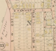
Platmap showing Fuller, Kain, and Kroehle Allotment. Kenneth Avenue, W.23rd St., W.22nd St.

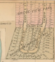
Platmap showing Bridgeview Allotments 1 and 2. Calgary Park area as it appeared prior to purchase by the City of Cleveland. See Hanna Estate and Stewart Land Company.
Formerly known as:
- Chestnut Avenue then Bridgeview Avenue
Post-1906 name:
- West 23rd Street
Original Owner:
Location:
- Township 7, Range 13, Original Lot 65 and Original Lot 64, in Cuyahoga County, Ohio
- South of Denison Avenue.
Chain of Ownership:
- (Note -- only the early owners are shown, up to the point of development)
- Richard Lord (as agent for the Western Reserve)
- Northern section in Original Lot 65 between Denison and Hurley Ave.
- Southern section in Original Lot 64 which includes Calgary Park
- William and Catherine Fuller
- Joel Fuller
- Hanna Estate
Development:
Named for:
- Bridgeview faced the Brooklyn-Brighton Bridge.
Notes:
Help support this website by visiting some of the Ads provided by Google.

