|
| |||||
Timeline
From Brooklyn Centre Wiki
(Difference between revisions)
| Line 1: | Line 1: | ||
| - | + | {| style="width:100%;" border="0" | |
| - | : | + | |-valign="top" align="left" |
| - | ''' | + | | '''BROOKLYN TOWNSHIP''' (TIME SPAN - 1816-18??) |
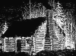
| - | : | + | [[Image:logcabin.jpg|right]] |
| + | :'''Organized 1 June 1818''', Brooklyn Township was the area of [[Cuyahoga County]] west of the '''[[Cuyahoga River]]''' prior to being annexed by Cleveland. Brooklyn's northern boundary was Lake Erie, it's eastern boundary was the [[Cuyahoga River]], it's southern boundary was Parma and Independence, and it's western boundary was Rockport. Brooklyn was township number 7 of range 13. [see the article on the [[Western Reserve]] for more information on how townships were numbered.] The early settlers had actually considered calling it Egypt because of the fertile land so suitable for growing corn. | ||
| - | '''1864''' - | + | |
| + | |||
| + | ===CITY OF OHIO=== | ||
| + | |||
| + | :(aka [[OHIO CITY]])''' (TIME SPAN - 3 Mar 1836-1854) | ||
| + | ::The area from the southern shore of Lake Erie to Walworth Run. | ||
| + | |||
| + | ::'''1836''' - | ||
| + | :::The residents of the northern part of Brooklyn incorporated their area as "'''The City of Ohio'''" later more commonly known as '''Ohio City'''. (<SMALL>See page 304 of Griswold, S. O., ''The corporate birth and growth of the city of Cleveland : an address to the Early Settlers' Association of Cleveland Cleveland: Western Reserve and Northern Ohio Historical Society'', 1884, 32 pgs.</SMALL>) | ||
| + | |||
| + | ::'''1837''' - | ||
| + | :::That part of Ohio City that lay south and west of the Barber & Sons allotment became known as '''Willeyville'''. Named, no doubt, for John W. Willey, Ohio City's first mayor. It was here that a riot almost occurred over the bridge built across the river at Columbus Street. (<SMALL>See page 305 of Griswold, S. O., ''The corporate birth and growth of the city of Cleveland : an address to the Early Settlers' Association of Cleveland Cleveland: Western Reserve and Northern Ohio Historical Society'', 1884, 32 pgs.</SMALL>) | ||
| + | |||
| + | ::'''1864''' - | ||
:Cleveland annexes that part of Brooklyn township that lay north of Walworth Run. | :Cleveland annexes that part of Brooklyn township that lay north of Walworth Run. | ||
| - | '''1867''' - | + | ::'''1867''' - |
:Cleveland annexes another part of Brooklyn township south of the original "City of Ohio". | :Cleveland annexes another part of Brooklyn township south of the original "City of Ohio". | ||
| - | '''1872''' - | + | ::'''1872''' - |
:Cleveland annexes more of Brooklyn township. | :Cleveland annexes more of Brooklyn township. | ||
| + | |||
| + | |||
| + | ===BROOKLYN VILLAGE=== | ||
| + | :aka '''BROOKLYN CENTRE''' (TIME SPAN - 1867-1894) | ||
| + | ::'''Organized in 1867'''. It comprised an area roughly from Daisy Avenue to Big Creek.<BR> | ||
| + | ::First mayor: Bethuel Fish<BR> | ||
| + | ::Area north of Daisy Avenue was annexed by Cleveland in 1890. The remainder was annexed in 1894. | ||
| + | |||
| + | ::Brooklyn Centre is located in the vicinity of the intersection of [[Denison Avenue]] and West 25th St. ([[Pearl Street]]) | ||
| + | |||
| + | ===BRIGHTON=== | ||
| + | :(TIME SPAN - 1833-18??) | ||
| + | ::Area south of Big Creek (sometimes referred to as Mill Creek). | ||
| + | |||
| + | |||
| + | ===SOUTH BROOKLYN=== | ||
| + | :(TIME SPAN - 1890-1906) | ||
| + | ::Short-lived successor to Brighton before being annexed to Cleveland. | ||
| + | |||
| + | ===BROOKLYN HEIGHTS=== | ||
| + | :(Formed in 1903) | ||
| + | |||
| + | |} | ||
| + | |||
| + | |||
| + | |||
| + | |||
| + | |||
| + | |||
| + | |||
---- | ---- | ||
{{back2main}} | {{back2main}} | ||
Revision as of 22:48, 6 January 2007
BROOKLYN TOWNSHIP (TIME SPAN - 1816-18??)
CITY OF OHIO
BROOKLYN VILLAGE
BRIGHTON
SOUTH BROOKLYN
BROOKLYN HEIGHTS
|
Help support this website by visiting some of the Ads provided by Google.

